
The 2026 Guide to U.S. Commercial Drone Laws: Complete Compliance Handbook
Introduction
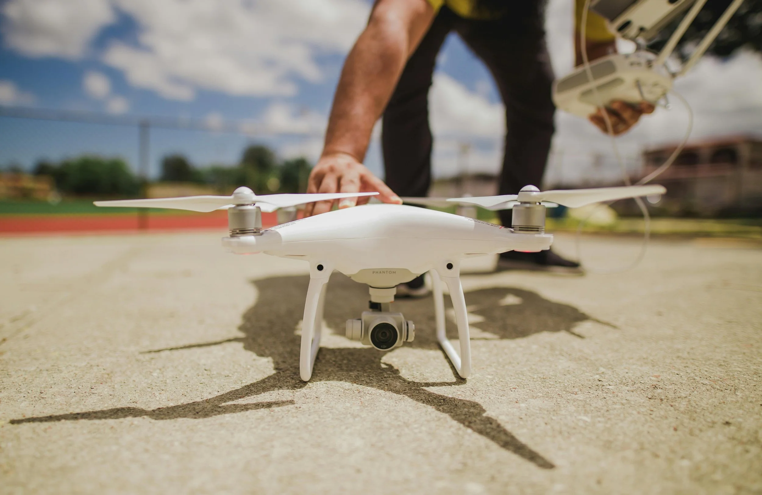
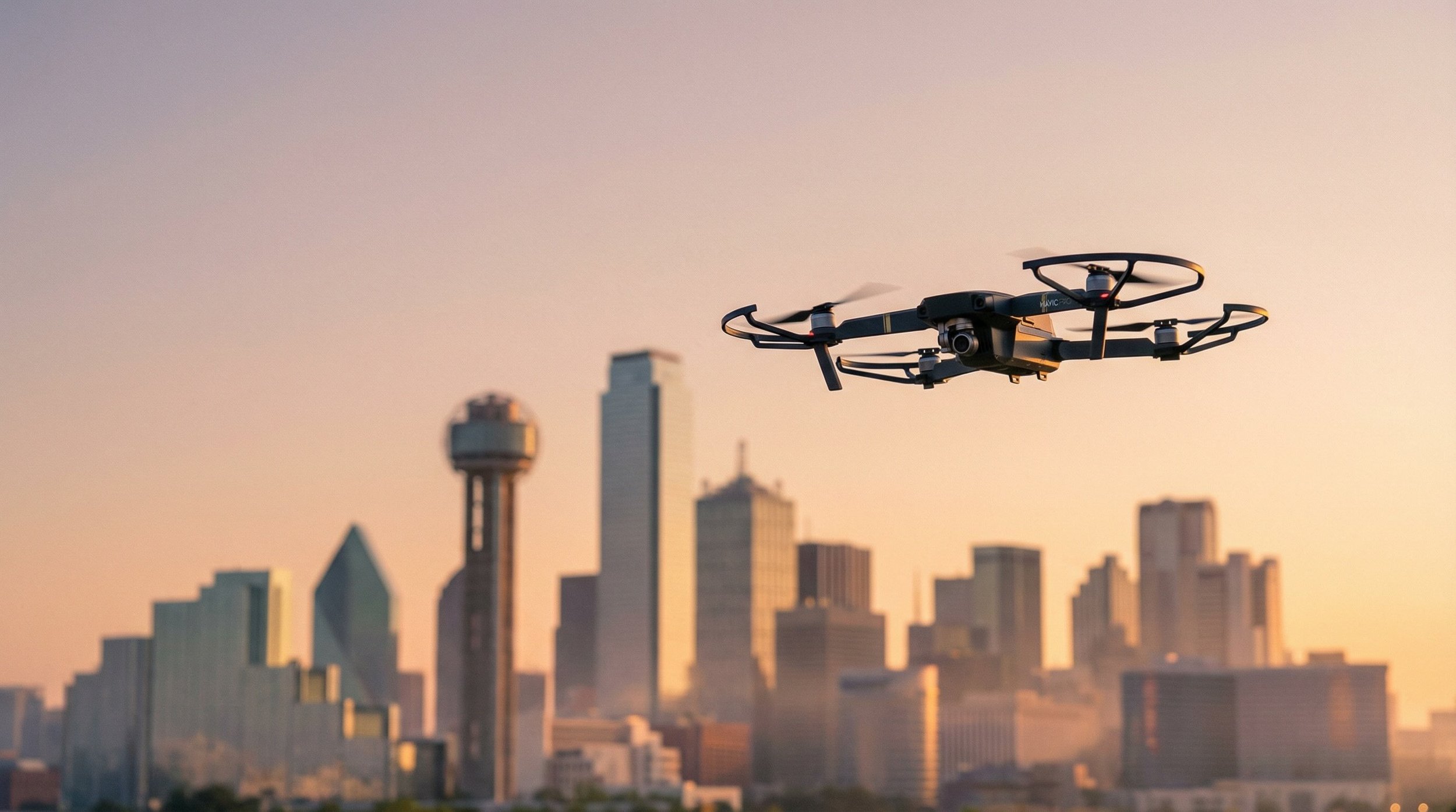
The commercial drone industry in 2026 stands at a critical regulatory crossroads. If you're running aerial photography services in Dallas-Fort Worth, documenting construction progress in Houston, or inspecting energy infrastructure across Texas, understanding federal and state drone laws isn't optional, it's the foundation of your business.
Why 2026 is different: Remote ID enforcement is now fully active with substantial penalties for non-compliance. The FAA has streamlined LAANC authorizations for night operations, issued thousands of Part 107 waivers for complex missions, and proposed new Part 108 regulations for routine Beyond Visual Line of Sight (BVLOS) operations. Meanwhile, Texas maintains some of the nation's strictest state-level privacy and critical infrastructure protections.
This guide is for:
Business owners contracting drone services
Marketing managers planning aerial shoots
Part 107 pilots expanding their operations
Construction and energy companies establishing internal drone programs
Anyone who needs commercial drone work done legally and safely
Not legal advice: This guide provides educational information only. Regulations change frequently. Always verify current requirements with the FAA and local authorities before flying.
Quick-Answer Summary: Commercial Drone Law Essentials (TL;DR)
✅ You need a Part 107 Remote Pilot Certificate for any commercial drone operation, even if unpaid or for "goodwill"
✅ Register every commercial drone over 0.55 lbs (250g) at FAADroneZone ($5 per drone, renews every 3 years)
✅ Remote ID is mandatory as of March 2024, your drone must broadcast identification data or you risk fines up to $27,500
✅ Part 107 certification requires: Being 16+, speaking English, passing the Aeronautical Knowledge Test, and TSA vetting
✅ VLOS (Visual Line of Sight) is the default, you must see your drone without binoculars unless you have a BVLOS waiver
✅ 400 feet AGL is your ceiling in uncontrolled airspace (higher when within 400 feet of a structure with permission)
✅ Controlled airspace requires authorization, use LAANC for near-instant approval at 732+ airports
✅ Night flying is allowed under Part 107 if your drone has anti-collision lighting visible for 3 miles (still need airspace auth in controlled airspace)
✅ Flying over people is categorized, you can fly over people if your drone meets Category 1, 2, 3, or 4 requirements (no waiver needed for Cat 1-3)
✅ Texas Chapter 423 prohibits imaging private property and critical infrastructure without permission, violations carry criminal penalties
✅ Insurance is not federally mandated but nearly all commercial clients require $1-2 million general liability coverage
✅ Waivers take 90+ days, plan complex operations (BVLOS, restricted areas) well in advance through DroneZone
Federal Drone Laws for Commercial Flying
Part 107: The Foundation of Commercial Drone Operations
FAA Part 107 (officially titled "Small Unmanned Aircraft Systems") is the federal regulation governing all commercial drone operations under 55 pounds in the United States. Published in 2016 and amended in 2021, Part 107 replaced the previous case-by-case exemption process with a standardized certification pathway.
Who needs Part 107?
You need Part 107 certification if you operate a drone for:
Business purposes: Real estate photography, construction documentation, roof inspections, agricultural surveys
Compensation: Any payment, trade, or benefit received for drone services
Commercial benefit: Marketing your own business, even if not directly paid for the flight
Goodwill operations: Volunteering your drone services for non-profits or community organizations
You do NOT need Part 107 for:
Purely recreational flying (hobby only, no business use)
Flying under 250 grams (0.55 lbs) recreationally without commercial purpose
⚠️ Common Mistake: "I'm not getting paid, so I don't need Part 107." Wrong. If the footage helps sell a property, promotes a business, or provides any commercial value, even indirectly, you need Part 107. The FAA defines commercial use broadly.
Part 107 Eligibility and Certification Process
Requirements:
Be at least 16 years old
Read, speak, write, and understand English
Be physically and mentally fit to safely operate a drone
Pass the FAA Aeronautical Knowledge Test (60 questions, 70% to pass, $175 fee)
Complete TSA security vetting
Certification steps:
Study for the test using FAA-approved materials (airspace, weather, regulations, operations, maintenance)
Create an IACRA profile at iacra.faa.gov to get your FAA Tracking Number (FTN)
Schedule the test at an FAA-approved testing center (PSI/CATS locations nationwide)
Pass the Aeronautical Knowledge Test (allows 2 hours, closed-book)
Complete FAA Form 8710-13 in IACRA within 90 days of passing
Receive your temporary certificate (valid immediately), permanent card arrives by mail
Recurrent training: Every 24 months, complete the free Part 107 Recurrent Training online course to maintain certification.
Cost breakdown:
Test fee: $175
Study materials: $0-200 (optional prep courses)
Total time: 2-4 weeks preparation for most pilots
Registration Rules: Every Commercial Drone Needs Its Own Number
Commercial drone registration differs significantly from recreational registration.
Federal requirements (14 CFR Part 48):
Register each drone weighing more than 0.55 lbs (250g) and less than 55 lbs
$5 per aircraft registration (valid for 3 years)
Each drone gets a unique registration number
Mark your registration number on the exterior (visible without tools) or interior (accessible without tools)
How to register:
Go to FAADroneZone.faa.gov
Create account or log in
Select "Register sUAS for Part 107"
Enter drone make, model, serial number, and Remote ID serial number
Pay $5 fee per drone
Print registration certificate and mark drone
Carry proof: Always have your registration certificate and Remote Pilot Certificate accessible during operations.
Core Part 107 Operational Rules
Altitude limits:
400 feet AGL maximum in uncontrolled (Class G) airspace
Exception: You may fly within 400 feet of a structure (building, tower, bridge) if you stay within a 400-foot radius of that structure, this allows roof inspections of tall buildings
Controlled airspace: Altitude limits vary by location; check UAS Facility Maps and obtain authorization
Visual Line of Sight (VLOS):
Remote Pilot in Command (RPIC) must keep the drone within unaided visual line of sight at all times
No binoculars, FPV goggles (as primary view), or screens as sole means of seeing the drone
Visual observers (VOs) may assist but don't replace RPIC's VLOS requirement
Exception: BVLOS operations require a Part 107 waiver with approved safety mitigations
Airspace and airports:
Class G (uncontrolled): Generally open for Part 107 operations below 400 feet
Class B, C, D, E (controlled): Requires prior FAA authorization via LAANC or DroneZone
Never fly in:
Prohibited areas (P-areas like White House, Camp David)
Restricted areas (R-areas) without authorization
Active Temporary Flight Restrictions (TFRs), check TFRmap.com or 1800wxbrief.com
Special Flight Rules Areas (SFRAs) without specific authorization
People and vehicles:
Operations over people: Allowed under Part 107 if drone meets Category 1, 2, 3, or 4 requirements (detailed below)
Operations over moving vehicles: Allowed in some scenarios if drone qualifies and operations are in restricted-access sites or over closed/restricted roadways
Not allowed: Operations from moving vehicles (except over sparsely populated areas, with waiver)
Night operations:
Allowed under Part 107 (as of April 2021 amendment)
Requirements:
Drone must have anti-collision lighting visible for at least 3 statute miles
RPIC must complete updated Part 107 recurrent training (or initial test taken after April 2021)
Controlled airspace still requires LAANC authorization for night ops
Lighting options: Strobes, LEDs, or built-in lights that flash or are steady (must be visible)
Right-of-way:
Yield to all manned aircraft
Never interfere with emergency response operations
Give way to other drones in emergency situations
Drug and alcohol:
No flying within 8 hours of consuming alcohol
Blood alcohol content must be below 0.04%
No flying under the influence of drugs that impair faculties
Remote ID: Your Drone's Digital License Plate
Remote ID became fully enforceable on March 16, 2024. This is one of the most significant regulatory changes since Part 107 launched.
What is Remote ID? Remote ID broadcasts your drone's identification, location, altitude, velocity, and control station location in real-time. Think of it as a digital license plate that allows the FAA, law enforcement, and other airspace users to identify drones in flight.
Who needs Remote ID?
All drones requiring FAA registration (over 0.55 lbs / 250g)
Both Part 107 commercial and recreational operators
Exempt: Drones under 250g flown recreationally (unless you register them anyway)
Three ways to comply:
Standard Remote ID (built-in from manufacturer)
Drone broadcasts via WiFi or Bluetooth directly
Manufactured after September 16, 2022
Check FAA Declaration of Compliance list to verify your model
Remote ID Broadcast Module (add-on device)
Aftermarket module attaches to older drones
Must be FAA-approved (check DOC database)
Limits operations to Visual Line of Sight
Part 107 pilots must register each module separately with unique serial number
FAA-Recognized Identification Area (FRIA)
Fly only at designated model airfields and community sites
No Remote ID required within FRIA boundaries
Find locations at FRIAmap.com
Impractical for commercial operations
Penalties for non-compliance:
Civil penalties up to $27,500 per violation
Possible certificate suspension
Criminal penalties in egregious cases
Registration with Remote ID:
Part 107 operators must enter Remote ID serial number when registering each drone
Go to FAADroneZone, edit device, add Remote ID info
Keep records of Remote ID compliance for each aircraft
LAANC: How to Get Airspace Authorization in Minutes
The Low Altitude Authorization and Notification Capability (LAANC) revolutionized how drone pilots access controlled airspace near airports. What once took weeks or months now happens in seconds.
What is LAANC? LAANC is an automated system that cross-references your requested flight location and altitude against FAA UAS Facility Maps, providing near-real-time airspace authorization for operations in controlled airspace.
Available at: 732 airports (as of 2026) covering the majority of Class B, C, D, and surface E airspace.
Who can use LAANC?
Part 107 commercial pilots
Recreational flyers (after completing TRUST)
How it works:
Download a LAANC app from an FAA-approved UAS Service Supplier:
Aloft (most popular, processes ~50% of authorizations)
AirMap
Kittyhawk
UASidekick
DroneDeploy (with Airspace Link integration)
B4UFLY (FAA's own app, view-only, not for authorization requests)
Check your flight location on the UAS Facility Map
Green grids: Auto-approved up to displayed altitude
Yellow grids: "Further coordination" required (submit 72 hours in advance)
Red areas: Not available through LAANC (apply via DroneZone)
Submit authorization request with:
Flight location (lat/lon or drawn area)
Requested altitude (at or below facility map ceiling for instant approval)
Date and time window (start/end, up to 90 days in advance)
Duration of operation
Receive instant approval (for requests within facility map limits) or further coordination response
LAANC at night: As of August 2021, LAANC supports night operations in controlled airspace. Still requires anti-collision lighting and recurrent training.
What LAANC does NOT do:
Grant waivers (those go through DroneZone)
Replace NOTAM checks or weather briefings
Override TFRs or stadium restrictions
Authorize operations above facility map ceilings without further coordination
📋 Pro tip: Request LAANC authorization at least 24-48 hours before complex shoots, even though approval is instant. This ensures you're not troubleshooting connectivity issues on-site while clients wait.
Part 107 Waivers: When Standard Rules Don't Fit
Some commercial operations can't comply with Part 107's operational limits. The FAA issues waivers allowing specific deviations when operators demonstrate equivalent safety.
Common waivable regulations (§107.205):
§107.25 - Operation from a moving vehicle/aircraft
§107.29 - Daylight operation (now largely unnecessary post-2021 rule)
§107.31 - Visual line of sight (BVLOS)
§107.33 - Visual observer requirements
§107.35 - Operation over people (largely superseded by Category 1-4 framework)
§107.39 - Operations over moving vehicles
§107.145 - Operations over human beings (in certain contexts)
Beyond Visual Line of Sight (BVLOS) waivers:
BVLOS is the most requested, and most complex, waiver category. These operations allow drones to fly beyond unaided visual line of sight, enabling:
Long-distance pipeline inspections
Linear corridor mapping (powerlines, railroads, highways)
Package delivery
Agricultural missions over large properties
Search and rescue in extended areas
Requirements for BVLOS approval:
Demonstrate how you'll maintain aircraft separation (detect and avoid systems, visual observers, shielded operations within 400 feet of structures)
Show ground risk mitigation (controlled access sites, sparsely populated areas, statistical analysis)
Provide detailed operational plans and crew training procedures
Specify exact geographic boundaries and altitudes
Address emergency procedures and lost link scenarios
Three BVLOS approaches:
Visual Observers (VOs): Station VOs along flight path to maintain continuous visual contact relay. VOs don't need Part 107 certificates but need two-way communication with RPIC.
Shielded Operations: Fly close to structures (buildings, trees, terrain) that shield the drone from manned aircraft, staying within 400 feet laterally and vertically of obstacles. Best for urban operations.
Detect and Avoid (DAA) Systems: Onboard technology (ADS-B receivers, radar, electro-optical sensors) that detects other aircraft and allows RPIC to take evasive action. Most sophisticated and expensive approach.
Public Safety BVLOS shortcuts: Government agencies may qualify for expedited waivers:
Shielded Operations Waiver: BVLOS within 1 statute mile of RPIC, shielded by terrain/structures, 1-2 week approval time
Certificate of Authorization (COA): Public aircraft operations under Part 91 (broader than Part 107)
Special Governmental Interest (SGI): Emergency situations requiring immediate deviation
Waiver processing time: 90 days average (plan accordingly). Incomplete applications take longer.
How to apply for a waiver:
Log into FAADroneZone
Navigate to Part 107 Dashboard
Select "Create Part 107 Waiver/Authorization" → "Operational Waiver"
Complete application including:
Specific regulation(s) you're requesting relief from
Geographic area and altitude (be specific, not nationwide)
Duration (up to 4 years, but start with shorter terms for faster approval)
Detailed Waiver Safety Explanation addressing:
Why you need the waiver (operational need)
How you'll mitigate risks to manned aircraft
How you'll mitigate risks to people and property on ground
Crew qualifications and training
Aircraft capabilities and redundancies
Emergency procedures
Attach supporting documents (operations manuals, training plans, aircraft specs, risk analyses)
Submit and monitor via DroneZone portal
What improves waiver approval odds:
Specificity (exact locations, dates, altitudes, not broad requests)
Detailed risk assessment and layered mitigations
Demonstrated experience and training
Conservative initial requests (expand after proving safety)
Clear, professional documentation
Precedent (reference similar approved operations when possible)
⚠️ Waiver reality check: BVLOS waivers are hard to get. The FAA approves only operations that clearly maintain equivalent safety. Budget for $10,000-50,000+ in preparation costs (risk analysis, documentation, equipment) for serious BVLOS operations.
Operations Over People: The Category System
The 2021 Part 107 amendment (Operations Over People rule) eliminated the blanket ban on flying over people, replacing it with four drone categories based on injury risk.
Category 1 (no waiver needed):
Drone weighs 0.55 lbs (250g) or less
No exposed rotating parts that could lacerate skin
Can fly over people, even crowds and moving vehicles
Examples: DJI Mini series, sub-250g racing drones
Category 2 (no waiver needed):
Drone does not cause injury greater than 11 foot-pounds of kinetic energy
Must be FAA-declared under means of compliance (check DOC database)
No sustained flight over open-air assembly (events with 1,000+ people concentrated)
Can fly over people not directly participating in operation
Examples: DJI Air 3, some Autel models
Category 3 (no waiver needed):
Drone doesn't cause injury greater than 25 foot-pounds of kinetic energy
Must be FAA-declared under means of compliance
Never over open-air assemblies
Can fly over people only in restricted-access sites (controlled areas where notice is given)
Examples: DJI Mavic 3 Enterprise, larger inspection drones
Category 4 (requires airworthiness certificate):
Drone has airworthiness certificate under Part 21
Has safety defect management system and production quality assurance
Rare for commercial small UAS; more for large advanced operations
Contact FAA Aircraft Certification Office
Critical rule for all categories: If you don't meet a category's requirements (wrong weight, no declaration of compliance, etc.), you cannot legally fly over people without a specific §107.39 waiver.
Sustained flight over open-air assemblies: Generally prohibited except Category 1 drones with safety declarations or operations with specific operational waivers addressing crowd risks.
State & Local Drone Laws: Navigating the Patchwork
The FAA has "exclusive sovereignty" over U.S. airspace (49 U.S.C. § 40103). However, states and cities can regulate:
Drone usage on state/local property (parks, government buildings)
Privacy, trespass, voyeurism, and harassment
Critical infrastructure protection
Law enforcement use of drones
Data collection and retention
Noise and nuisance
What states/cities CANNOT regulate:
How drones operate in the air (altitude, speed, equipment requirements)
Airspace access and flight paths
Pilot qualifications
Aircraft registration and marking
Federal preemption principle: If a state/local law directly conflicts with FAA authority over airspace, the state/local law is likely invalid. Several such laws have been overturned in court.
How to Check Local Regulations
Step-by-step checklist:
☑️ 1. Identify your operation location
Exact address or GPS coordinates
City and county
Public vs. private property
Distance to airports, helipads, critical infrastructure
☑️ 2. Check state laws
Google: "[State name] drone laws commercial"
Visit state aviation department or film commission website
Review state statutes on drones/UAS (often in government code or penal code)
Look for restrictions on:
Imaging private property
Critical infrastructure flyovers
Specific prohibited zones (state parks, correctional facilities, dams)
☑️ 3. Check local city/county ordinances
Visit city/county website → search "drone" or "unmanned aircraft"
Check municipal code (often available online)
Call city attorney or parks department if unclear
Common local restrictions:
Parks and recreation areas (many prohibit drone launches/landings)
Public event flight restrictions
Noise ordinances (rare but exist)
Permit requirements for commercial filming
☑️ 4. Verify with property owner/manager
If flying over private property: Written permission from owner
If flying from private property: Launch/landing permission from owner
If flying near businesses: Notify adjacent properties as courtesy
For shopping centers, office parks: Property management approval
For residential areas: HOA rules may apply
☑️ 5. Check special-use restrictions
National parks: Prohibited without special use permit (NPS drone policy)
State parks: Varies by state; most require filming permits
Wildlife areas: Often prohibited to avoid disturbing animals
Military installations: Restricted airspace, don't even try
Power plants, dams, refineries: Check critical infrastructure laws
Stadiums/sports venues: Federal restrictions within 1 hour of scheduled events, 3-mile radius
☑️ 6. Document everything
Email confirmations from property owners
Screenshots of local ordinances (laws change)
Permit applications and approvals
Notes from phone calls with officials (date, name, position, summary)
Common Local Restrictions by Category
Parks and recreation:
Many city/county parks prohibit drone operations entirely
Some have designated flying areas
Always check park rules before assuming it's legal
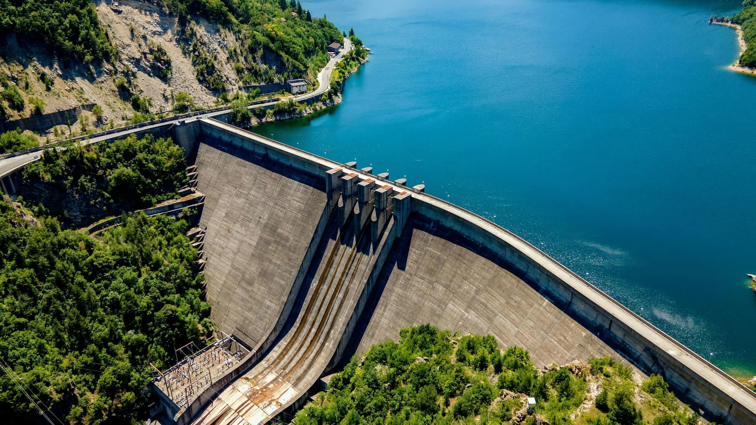
Critical infrastructure:
Power plants, substations, water treatment facilities, oil refineries, chemical plants, dams
Many states criminalize low-altitude flights over these facilities
Texas: Class B misdemeanor for flying below 400 feet over critical infrastructure without written consent
Government facilities:
Courthouses, jails, detention centers
State capitols (e.g., Texas Capitol Complex restricted)
Military bases (controlled airspace + trespassing laws)
Special events:
Sporting events: Federal TFR (Temporary Flight Restriction) within 3 nautical miles, up to 3,000 feet AGL, during and 1 hour before/after major events
Concerts and festivals: Local ordinances often prohibit drones for safety
Protests and political rallies: Check local emergency orders
📱 Use these tools to check airspace and restrictions:
B4UFLY (FAA's official app): Airspace restrictions, TFRs, advisories AirMap or Aloft: Live airspace map, LAANC, advisories TFR Map: Real-time temporary flight restrictions SkyVector: Sectional charts showing airspace classes
Commercial Drone Work: Additional Compliance Businesses Overlook
Insurance: Protecting Your Business
Drone insurance isn't federally mandated for Part 107 operations, but it's essential for business viability.
Why you need it:
Liability protection: Covers damage to third-party property or injury to people if your drone crashes
Equipment protection: Covers repair/replacement if drone is damaged or stolen
Client requirements: Nearly all commercial clients require proof of insurance before contracts
Cost expectations:
Liability-only: $500-1,500/year for $1 million coverage
Liability + Hull: $1,500-3,500/year depending on equipment value and claims history
Rates vary by: operation type (real estate vs. construction), equipment value, geographic area, pilot experience, safety record
Insurers specializing in drones:
SkyWatch.AI (on-demand, hourly coverage)
Verifly (on-demand, per-flight)
BWI Aviation Insurance
Global Aerospace
Thimble
AVION Insurance
Policy tips:
Admitted vs. non-admitted: Admitted policies are state-approved and more secure; non-admitted offers broader coverage but less regulatory protection
Named insured vs. additional insured: Clients often require being added as "additional insured" on your policy
Coverage territory: Ensure your policy covers all states where you operate
Exclusions: Read carefully, some policies exclude certain operations (night flying, over water, specific industries)
Client Contracts and Location Permissions
Client service agreement essentials:
Every commercial job should have a written agreement covering:
Scope of work: Specific deliverables (number of photos/videos, editing level, file formats, resolution)
Timeline: Shoot date(s), weather contingencies, delivery deadline
Pricing and payment terms: Fees, deposit requirements, payment schedule, late fees
Usage rights: Who owns raw footage vs. edited deliverables? Exclusive or non-exclusive license? Duration of license?
Liability and indemnification: Who's responsible if something goes wrong?
Insurance requirements: Minimum coverage amounts, additional insured requests
Regulatory compliance: Statement that you hold valid Part 107 certificate and will operate within FAA regulations
Cancellation and rescheduling: Weather delays, equipment failure, force majeure
Property owner permissions:
You generally need permission to:
Fly over private property: Even though you're in federal airspace, you need consent to surveil or image private property in many states (especially Texas)
Launch/land from private property: You're trespassing if you enter property without permission
Image people on private property: Privacy laws (state-specific) protect people from unwanted surveillance
How to get permission:
Written consent: Email or signed location agreement is best
Specify scope: Date(s), time window, general activity ("aerial photography for marketing purposes")
Address concerns: Noise, privacy, safety, insurance
For complex locations: Large properties, multiple owners, HOAs, get legal advice
📄 Sample language for property permission: "Property owner grants [Your Company] permission to operate unmanned aircraft systems on and above the property located at [Address] on [Date(s)] between [Time] for the purpose of [Photography/Videography/Inspection] in compliance with all FAA regulations."
Privacy, Releases, and Data Handling
State privacy laws vary widely. Texas Chapter 423 (discussed below) is particularly strict. General best practices:
People in your footage:
Public spaces: Generally no release needed if filming from public airspace showing public scenes
Private property: If identifiable people appear in footage used commercially, a model release is recommended
Sensitive situations: Schools, medical facilities, private events, always get releases
Image usage restrictions:
Don't: Capture images through windows or over fences clearly intended to provide privacy
Don't: Persistently surveil specific individuals
Do: Inform people if you're filming in areas where they have reasonable expectation of privacy
Do: Offer to delete footage if someone objects (depends on jurisdiction)
Data security:
Encrypt sensitive data: Construction progress, infrastructure inspection images may contain proprietary or security information
Secure storage: Cloud storage should be encrypted, access-controlled
Client data agreements: Specify how you'll handle, store, and dispose of client data
Retention policies: How long you keep raw footage, who can access it, when it's deleted
HIPAA and construction site confidentiality:
Medical facilities may require HIPAA business associate agreements
Construction sites often have proprietary designs, NDAs are common
Safety Checklists and Documentation
Professional drone operations require systematic pre-flight planning and documentation.
Pre-flight checklist (every flight):
☑️ Regulatory compliance:
Part 107 certificate valid and on person
Drone registration current, number marked on aircraft
Remote ID compliant and broadcasting
Airspace authorization obtained (LAANC or DroneZone approval)
Check NOTAMs, TFRs (1800wxbrief.com or FAA apps)
☑️ Weather assessment:
Wind speed below 25 mph (drone-dependent)
Visibility at least 3 statute miles
Cloud clearance: 500 feet below, 1,000 feet above, 2,000 feet horizontal (in Class G)
No precipitation, fog, or icing conditions
Temperature within drone operating limits
☑️ Site survey:
Check for obstacles (power lines, trees, towers, manned aircraft)
Identify emergency landing zones
Note people and vehicles in area (separation requirements)
Assess ground hazards if crash occurs
☑️ Aircraft inspection:
Batteries fully charged (including remote controller and tablet)
Propellers secure, undamaged, balanced
Camera/gimbal functional, lens clean
Firmware up to date
GPS lock acquired, adequate satellites
Compass calibrated (if needed)
Remote ID broadcasting verified
☑️ Crew briefing:
Roles and responsibilities (RPIC, VO, safety officer)
Communication plan (radio, hand signals)
Emergency procedures (lost link, low battery, manned aircraft encounter)
Flight plan review (route, altitudes, duration)
☑️ Risk assessment:
What could go wrong? (equipment failure, weather change, unauthorized people entering area)
Mitigations in place? (geofencing, return-to-home set, backup batteries, VO coverage)
Flight log documentation:
Maintain a logbook (digital or paper) for every flight:
Date and time
Location (address or GPS coordinates)
Drone model and registration number
RPIC and crew
Purpose of flight
Takeoff and landing times
Flight duration
Weather conditions
Airspace class and authorization (if applicable)
Incidents or anomalies
Why logs matter:
FAA inspections and audits
Insurance claims
Waiver applications (demonstrated experience)
Legal defense if incident occurs
Business records for tax purposes
Special Scenarios: What's Allowed and What You Need
Construction Sites
What's allowed:
Progress documentation from perimeter or owner-controlled areas
Aerial mapping and surveying for site planning
Inspections of structures, scaffolding, roofs
Safety monitoring and logistics
What you need:
Part 107 certificate
Site manager approval (written)
Coordination with site safety officer (active construction)
Check for controlled airspace near urban sites (many are)
LAANC authorization if near airports
Safety considerations:
Cranes and heavy equipment may penetrate 400 feet AGL
Falling hazards below if structure collapses
VOs to watch for manned aircraft (helicopters common at large sites)
Hard hat, hi-vis vest if landing/taking off within site boundaries
Oil & Gas / Energy Sector Sites
What's allowed:
Pipeline inspections (usually requires BVLOS waiver)
Facility inspections (refineries, compressor stations, tank farms)
Flare stack monitoring
Solar panel and wind turbine inspections
Transmission line and substation surveys
What you need:
Part 107 certificate
Facility-specific authorization: Energy companies have strict security protocols; expect lengthy approval process
Site safety training: H2S awareness, confined spaces, PPE requirements
Insurance: Higher limits (often $5-10 million) due to explosion/fire risk
Check state laws: Texas restricts imaging critical infrastructure without consent (see below)
BVLOS waiver: If inspecting long linear assets (pipelines, powerlines)
Specialized equipment: Thermal cameras for hotspot detection, long-range drones for large facilities
Texas-specific: Flying over oil/gas facilities at less than 400 feet AGL is prohibited without written consent (Texas Gov't Code §423.0045).
Real Estate
What's allowed:
Residential property photography/video for listings
Commercial property marketing
Land surveys for acreage sales
Neighborhood and amenity overviews
What you need:
Part 107 certificate
Listing agent or property owner permission
Privacy compliance: Don't capture neighbors' backyards prominently (Texas privacy law issues)
HOA rules: Some prohibit drone use; check before flying
Avoid school zones: If property is near schools, be cautious about flight times (children present)
MLS compliance: Some Multiple Listing Services have specific rules about aerial images; verify with agent
Marketing tip: Emphasize legally compliant operations in your contracts. Real estate agents face liability for improper drone use by contractors.
Events and Crowds
What's allowed:
Festivals, concerts, outdoor markets IF:
Category 1 drone (under 250g, no exposed rotors), OR
Flying from restricted-access area with no sustained flight over assembly, OR
Specific waiver for operations over people in open-air assembly
What you need:
Part 107 certificate
Event organizer permission (written)
Check for TFRs: Sporting events create 3-mile no-fly zones
Check local ordinances: Many cities ban drones at public events without permit
Insurance with event coverage: General liability must cover events
Safety plan: Emergency landing procedures, crowd notifications, VOs
Operations over people compliance: Meet Category 1-3 requirements or have waiver
Stadium/sporting event rule: Federal regulation (49 U.S.C. § 40103 note) prohibits drones within 3 nautical miles of stadium, up to 3,000 feet AGL, from 1 hour before to 1 hour after event start for:
MLB, NFL, NCAA Division I football, NASCAR Cup/Xfinity/Truck, Indy car
Capacity 30,000+ people
Violation: Civil penalty up to $30,000 + criminal prosecution.
Near Airports
What's allowed:
Commercial operations in controlled airspace with prior authorization
Part 107 allows operations in Class B, C, D, E airspace if approved via LAANC or DroneZone
What you need:
Part 107 certificate
LAANC authorization (most common): Submit request via approved app, receive instant or near-instant approval for altitudes within UAS Facility Map limits
DroneZone authorization: For airports not on LAANC, or altitudes above facility map ceilings, submit manually, wait for approval (weeks)
Further coordination: Some requests require air traffic facility review (72 hours advance notice)
Never assume it's okay: Even if flying under 400 feet, if you're near an airport in controlled airspace, you MUST get authorization
Airport proximity best practices:
Check airspace class on sectional chart or B4UFLY
Call airport manager as courtesy (not required but appreciated)
Communicate with air traffic control if requested in authorization
Abort immediately if manned aircraft approaches
Don't fly in approach/departure paths even if outside surface areas
Night Operations
What's allowed:
Any Part 107 operation allowed during day, also allowed at night (as of April 2021 rule)
Same altitude, airspace, and VLOS requirements
What you need:
Part 107 certificate with updated training (initial test after April 2021, or recurrent training completed)
Anti-collision lighting: Visible for at least 3 statute miles (strobes recommended)
LAANC authorization: If operating in controlled airspace, request night authorization via LAANC (supported as of August 2021)
Enhanced safety measures:
Brighter lights on landing zone
Visual observers with flashlights for traffic watch
Pre-flight site survey during daylight
Lower altitudes for easier visual tracking
Conservative battery management (darkness makes emergency landings harder)
Night-specific hazards:
Harder to see obstacles (wires, trees)
Disorientation more likely (reference horizon, use attitude indicators)
Harder for manned aircraft to see you (even with anti-collision lights)
Wildlife (birds, bats) more active at dusk/dawn
Flying in Cities / Downtown Areas
What's allowed:
Commercial operations in urban areas, subject to standard Part 107 rules
Often Class B, C, or D airspace → requires authorization
VLOS still required (challenging in urban canyons)
What you need:
Part 107 certificate
LAANC authorization for controlled airspace
Building owner permission if flying from rooftops or private property
Shielded operations for BVLOS: If pursuing BVLOS in urban areas, shielded operations (staying close to buildings) is most realistic waiver path
Awareness of helicopter traffic: Many urban areas have medevac helicopters, news choppers, air tours
Avoid crowds: Unless Category 1 or within restricted-access site
Urban flight challenges:
GPS interference (tall buildings, multipath)
Magnetic interference (rebar, electrical systems)
Unpredictable wind patterns (building-generated turbulence)
Limited landing zones
Public interaction (curious onlookers, security guards, police)
Best practices:
Fly early morning (less traffic, better light)
Have VOs watching different directions
Brief local security/police before flight (avoid 911 calls)
Carry Part 107 certificate and FAA documents to show officials if questioned
Drone Laws in Texas for Commercial Use (2026)
Texas presents a unique regulatory landscape. The state has enacted some of the nation's strictest privacy and critical infrastructure protections via Texas Government Code Chapter 423.
Texas Chapter 423: Imaging Restrictions
What it prohibits:
It's illegal to use a drone to capture an image of:
Private property with intent to conduct surveillance, if:
The property is fenced or otherwise physically excluded, OR
The property is clearly marked with "no trespassing" signs
Critical infrastructure facilities at altitude less than 400 feet AGL without written consent
Penalties:
Surveillance violation (§423.003): Class C misdemeanor (up to $500 fine)
Disclosure of illegally captured images (§423.004): Class B misdemeanor (up to $2,000 fine, 180 days jail)
Civil liability: Property owners can sue for $5,000 + attorney fees for illegal capture, $10,000 + fees for disclosure
What IS legal (§423.002 exemptions):
Capturing images for professional or scholarly research on behalf of a university
Operations at FAA test sites or ranges
Military operations
Mapping (satellite images, drones arguably similar)
Utility and telecommunications work (electric, gas, telecom providers for infrastructure inspection, not general surveillance)
With consent of property owner
Insurance purposes (adjusters documenting claims)
Oil and gas pipeline surveys by operators
Real estate marketing (with seller permission)
Law enforcement with warrant or exigent circumstances
Media coverage of public events or matters of public interest in public airspace
Commercial implications:
Real estate photography: Always get seller consent in writing before shooting property
Construction progress docs: Verify you have permission from property owner
Marketing shots of businesses: Get business owner approval if clearly identifiable
Don't hover over neighbors' yards while shooting adjacent property
Critical infrastructure definition (§423.0045):
Power plants, substations, switching stations
Chemical, polymer, rubber manufacturing
Water treatment facilities, pump stations
Dams classified as high hazard
Concentrated animal feeding operations
Military installations (federal, state, local)
Oil, gas, chemical pipelines (above ground portions)
Refineries
Correctional facilities
Practical guidance: If your operation involves critical infrastructure in Texas, contact the facility in advance and secure written permission. Keep copies on-site during operations.
Texas State-Specific Rules
Local government regulation limits (§423.0045):
Cities and counties generally cannot regulate drone operations (preempted by FAA)
Exceptions: Local governments CAN regulate:
Drone use during special events
Drones operated by the locality itself
Launch/landing on government property (parks, buildings)
Texas Parks & Wildlife:
Drones prohibited in most Texas State Parks without filming permit
Exceptions: San Angelo State Park and Martin Dies Jr. State Park have designated RC/drone areas
Apply for permits weeks in advance for commercial shoots
Drone-based wildlife harassment:
Texas Parks & Wildlife Code: Using drones to hunt, drive, capture, count, or photograph wildlife without permit is illegal
Requires Aerial Management Permit (AMP) and Landowner Authorization (LOA) from Texas Parks & Wildlife Department
"Photograph" includes using drones to locate game or disturb animals
Impact on commercial work: Don't fly low over pastures, wildlife areas, or refuges without landowner permission and awareness of regulations
DFW Area Compliance Checklist
The Dallas–Fort Worth metroplex presents specific challenges due to dense airspace (DFW International, Love Field, multiple regional airports) and extensive controlled airspace.
Before every DFW area flight:
☑️ Check airspace class:
DFW International (KDFW): Class B (surface to 11,000 ft in core), LAANC required for most of region
Dallas Love Field (KDAL): Class B, LAANC required
Fort Worth Alliance (KAFW), Addison (KADS), others: Class D or E, LAANC or DroneZone required
☑️ Use LAANC for controlled airspace:
Aloft, AirMap, Kittyhawk, etc.
Submit at least 24 hours before shoot to avoid last-minute issues
Check UAS Facility Maps for approved altitudes
☑️ Check TFRs and NOTAMs:
Presidential TFRs when president visits Dallas/Fort Worth
Stadium TFRs: Cowboys Stadium (Arlington), Rangers/Cowboys games, TCU/SMU/UNT games
TFRMap.com for current TFRs
☑️ Verify local ordinances:
Dallas: Generally follows federal preemption but has park rules prohibiting launch/landing in parks without permit
Fort Worth: Similar; check park-specific rules
Plano, Frisco, McKinney, suburbs: Check city websites for drone policies (often limited to park use)
☑️ Property permissions:
Urban shoots: Get building owner consent
Residential: HOA rules common (many restrict drone use)
Commercial properties: Contact property management
☑️ Cultural/event awareness:
State Fair of Texas (Fair Park): TFR during event
Major concerts/festivals: Check for local flight bans
Cowboys/Rangers home games: 3-mile TFR
DFW-specific tips:
Early morning flights (6-8 AM) have less manned aircraft traffic and better LAANC availability
Downtown Dallas/Fort Worth: Expect frequent helicopter traffic (news, medevac, police)
Use VOs aggressively, busy airspace requires constant vigilance
Consider joining Dallas Drone Society or local UAS meetups for area-specific knowledge sharing

FAQs: Commercial Drone Laws 2026
1. Do I need a license to fly a drone commercially in 2026?
Yes. Anyone operating a drone for commercial purposes in the United States must hold an FAA Part 107 Remote Pilot Certificate. Commercial purposes include any flight conducted for business, compensation, or goodwill (even if unpaid). The certification requires:
Being at least 16 years old
Passing the FAA Aeronautical Knowledge Test ($175, 60 questions, 70% to pass)
Completing a TSA security background check
Certification typically takes 2-4 weeks after passing the test. It's valid indefinitely but requires completing recurrent training every 24 months.
2. How much does it cost to get a Part 107 license?
Total cost: $175-375.
Test fee: $175 (required, paid to testing center)
Study materials: $0-200 (optional, FAA provides free study guides, or invest in prep courses from Gold Seal, Pilot Institute, or Remote Pilot 101)
Renewal: Free (online recurrent training every 24 months)
There are no ongoing license fees. Drone registration costs $5 per aircraft every 3 years (separate from the pilot certificate).
3. What is Remote ID and do I need it for my commercial drone?
Remote ID is mandatory as of March 16, 2024 for all drones requiring FAA registration (over 0.55 lbs / 250g). It broadcasts your drone's identification, location, and control station info in real-time, like a digital license plate.
You need Remote ID if:
Your drone weighs more than 250 grams (0.55 lbs)
You're flying commercially or recreationally
Three compliance paths:
Built-in Remote ID: Drones manufactured after Sept 16, 2022 often have it built-in (check FAA Declaration of Compliance list)
Broadcast module: Add FAA-approved aftermarket module to older drones
Fly in FRIA zones: FAA-Recognized Identification Areas (only at designated RC fields, impractical for commercial work)
Penalties for non-compliance: Up to $27,500 civil penalty per violation. The FAA is actively enforcing this regulation.
4. Can I fly my commercial drone at night in 2026?
Yes, Part 107 allows night operations. The 2021 rule change eliminated the need for night waivers. Requirements:
Anti-collision lighting: Visible for at least 3 statute miles (strobes or steady lights)
Updated training: Complete Part 107 recurrent training (or take initial test after April 2021)
Airspace authorization: Still need LAANC approval if operating in controlled airspace, now available for night ops
Night flying presents additional hazards (harder to see obstacles, disorientation risk), so use enhanced safety measures like visual observers, pre-flight site surveys during daylight, and conservative battery management.
5. How do I get permission to fly near an airport?
Use LAANC (Low Altitude Authorization and Notification Capability) for instant or near-instant airspace authorization:
Download FAA-approved app (Aloft, AirMap, Kittyhawk, etc.)
Check your flight location on UAS Facility Map
Submit request with location, altitude, date/time
Receive instant approval if within facility map limits
LAANC covers 732+ airports in Classes B, C, D, and surface E airspace. If your airport isn't on LAANC or you need altitude above facility map ceiling, apply via FAADroneZone (takes days/weeks).
Never fly near an airport without authorization in controlled airspace, it's a federal violation with serious penalties.
6. What insurance do I need for commercial drone work?
Insurance isn't federally mandated, but clients universally require it. Standard commercial drone insurance:
General Liability: $1-2 million per occurrence (covers property damage, bodily injury caused by your operations)
Hull Coverage (optional but recommended): Covers your drone equipment damage/loss
Cost: $500-3,500/year depending on coverage limits and equipment value
Most clients require you to carry liability insurance and often request to be added as "additional insured." Major insurers: SkyWatch, Verifly, BWI Aviation, Global Aerospace. Some offer on-demand, per-flight policies if you fly infrequently.
7. Are there special drone laws in Texas for businesses?
Yes, Texas Chapter 423 restricts drone imaging:
Cannot capture images of private property with surveillance intent if property is fenced or posted "no trespassing" (without owner consent)
Cannot fly below 400 feet over critical infrastructure (power plants, refineries, dams, etc.) without written consent
Penalties: Class C misdemeanor ($500 fine) for surveillance; Class B misdemeanor ($2,000 fine, 180 days jail) for disclosing illegal images
Civil liability: $5,000-10,000 + attorney fees
Exemptions: Real estate marketing (with seller permission), insurance claims, utility work, media coverage of public interest in public airspace, and operations with property owner consent.
Always get written permission from property owners in Texas before commercial shoots. Document permissions carefully.
8. Can I fly over people with my Part 107 license?
Yes, if your drone qualifies under the operations over people rule. Four categories:
Category 1: Drones under 0.55 lbs (250g), no exposed rotors, can fly over people and crowds
Category 2: Drones causing less than 11 ft-lbs kinetic energy, FAA-declared, can fly over people, not crowds
Category 3: Drones causing less than 25 ft-lbs kinetic energy, FAA-declared, only in restricted-access sites
Category 4: Airworthiness certificate required (rare)
If your drone doesn't meet a category's requirements, you cannot legally fly over people without a specific Part 107 waiver. Check the FAA Declaration of Compliance database to see if your drone model is approved.
9. What happens if I fly a drone without proper authorization?
Penalties for illegal drone operations:
Civil penalties: $1,100-$27,500+ per violation (common violations: no Part 107 certificate, no airspace authorization, no Remote ID)
Certificate suspension/revocation: Loss of Part 107 certificate (temporary or permanent)
Criminal prosecution: Federal charges for dangerous operations, interference with aircraft, or flying in prohibited areas (fines up to $250,000, imprisonment up to 3 years)
State/local charges: Trespassing, privacy violations, critical infrastructure violations (Texas Chapter 423)
Civil lawsuits: Property owners or injured parties can sue for damages
The FAA is increasing enforcement through initiatives like Compliance Philosophy and coordination with local law enforcement. Don't risk your business, operate legally.
10. How long does a Part 107 waiver take to get approved?
Average processing time: 90 days. Some factors affecting timeline:
Application completeness: Incomplete applications take much longer (sometimes 6+ months)
Waiver complexity: Simple operational waivers (night operations pre-2021) were faster; BVLOS waivers are most complex
Geographic scope: Specific locations approve faster than nationwide requests
Precedent: If similar waivers have been granted, approval is faster
Public safety: Emergency/government waivers can be expedited
Tips to speed approval:
Submit highly detailed safety explanations
Start with conservative requests (limited geography, altitudes, duration)
Reference similar approved waivers when possible
Respond quickly to FAA questions
Some public safety agencies qualify for shielded operations waivers with 1-2 week approval times. Plan major waiver-dependent operations months in advance.
11. Do I need a waiver to fly Beyond Visual Line of Sight (BVLOS)?
Yes, BVLOS operations require a Part 107 waiver under §107.31. Standard Part 107 requires maintaining visual line of sight without binoculars or devices.
BVLOS waivers are granted when you demonstrate equivalent safety through:
Visual observers stationed to maintain sight relay
Shielded operations (staying within 400 feet of structures that shield from manned aircraft)
Detect and Avoid systems (onboard technology to detect other aircraft)
BVLOS waivers are difficult to obtain and require extensive documentation (safety analysis, crew training, procedures, emergency protocols). Budget $10,000-50,000+ in preparation costs. Processing takes 90+ days. Future Part 108 regulations may streamline this process but aren't finalized as of 2026.
12. Can I operate a drone business from any state if I'm certified?
Your Part 107 certificate is valid nationwide, but you must comply with state and local laws in each area you operate:
Check state-specific privacy and imaging laws (Texas Chapter 423, California AB 856, etc.)
Verify local ordinances (park restrictions, permit requirements, noise rules)
Obtain filming permits where required (many cities require permits for commercial shoots)
Register your business according to state/local requirements (business licenses, sales tax collection)
Ensure your insurance covers operations in all states where you work
If you primarily operate in one state but occasionally work elsewhere, research regulations for each new state before accepting contracts. Laws vary significantly, what's legal in one state may be criminal in another.
13. How do I know if I'm in controlled airspace?
Check airspace class using these tools:
B4UFLY app (FAA official): Shows airspace, restrictions, advisories
SkyVector.com: Sectional charts with airspace boundaries
LAANC apps (Aloft, AirMap): Live airspace maps with authorization status
FAA UAS Facility Maps: Detailed grids showing approved altitudes
Airspace classes:
Class A: 18,000 ft+ (not relevant for drones)
Class B: Major airports (e.g., DFW, Dallas Love Field), multiple altitude tiers, authorization always required
Class C: Medium airports, typically 5 NM radius, surface to 4,000 ft
Class D: Smaller airports, typically 5 NM radius, surface to 2,500 ft
Class E: Controlled airspace that isn't A, B, C, D, often starts at 700 or 1,200 ft AGL
Class G: Uncontrolled, generally no authorization needed below 400 ft
If in doubt, check! Operating without authorization in controlled airspace is a federal violation.
14. What should I do if approached by law enforcement while flying?
Remain calm and professional:
Immediately land your drone safely (or have crew continue safe operations while you speak with officers)
Identify yourself and explain you're conducting commercial operations
Show your credentials:
Part 107 Remote Pilot Certificate (physical card or digital copy)
Drone registration certificate
Airspace authorization (LAANC approval screenshot, DroneZone document)
Property owner permission (if available)
Explain your operation briefly: "I'm a licensed commercial drone pilot documenting [purpose] with FAA authorization."
Answer questions honestly but don't volunteer unnecessary information
Know your rights: You're not required to delete footage or hand over equipment without a warrant (but comply with lawful orders)
Get officer's information: Name, badge number, agency for your records
Document the encounter: Notes, photos (if appropriate), timestamps
If challenged on regulations:
Politely reference FAA Part 107 and federal preemption of airspace
Offer to provide documentation later if officer requests
Don't argue, escalate through proper channels if you believe officer is mistaken
Common law enforcement concerns:
Privacy complaints from residents
Suspected surveillance or illegal activity
Operating too close to critical infrastructure
Noise complaints
Most encounters resolve quickly when you demonstrate professionalism and regulatory compliance. Keep documentation organized and easily accessible.
Conclusion: Fly Legal, Fly Confident
Commercial drone operations in 2026 require navigating a complex web of federal regulations, state laws, local ordinances, and industry best practices. The stakes are high, violations can result in substantial fines, certificate suspension, criminal charges, and irreparable damage to your business reputation.
Key takeaways:
Part 107 certification is non-negotiable for any commercial operation
Remote ID compliance is mandatory and actively enforced
LAANC has streamlined airspace access, but you must still request authorization
Texas has strict imaging and critical infrastructure laws, always get written permissions
Insurance protects your business even though it's not federally required
Documentation and pre-flight planning are your best defense against regulatory violations
The commercial drone industry is maturing rapidly. Future regulations like Part 108 promise to expand BVLOS operations, while technology advances (detect-and-avoid systems, 5G connectivity, AI-powered automation) will enable increasingly sophisticated missions.
Stay current with FAA rule changes, maintain meticulous documentation, invest in ongoing training, and never cut corners on compliance. Your reputation depends on operating legally and safely, every single flight.
Resources to bookmark:
Commercial Drone Compliance Checklist (2026)
Print this checklist and keep it with your flight kit:
Before Every Job
☐ Verify Part 107 certificate is current (expires every 24 months, requires recurrent training)
☐ Confirm drone registration is valid (renews every 3 years, each drone separately)
☐ Check Remote ID compliance (broadcasting, module registered, or flying in FRIA)
☐ Obtain client agreement (scope, pricing, deliverables, liability, insurance requirements)
☐ Get property owner written permission (launch/landing locations, imaging private property)
☐ Verify insurance coverage (policy active, covers operation type, add additional insured if requested)
☐ Research state/local laws (Texas Chapter 423, local ordinances, park rules, filming permits)
☐ Check airspace class (B4UFLY, SkyVector, UAS Facility Maps)
☐ Obtain airspace authorization (LAANC or DroneZone approval if in controlled airspace)
☐ Check for TFRs and NOTAMs (1800wxbrief.com, TFRmap.com, LAANC app advisories)
Day of Flight
☐ Weather check (wind under 25 mph, visibility 3+ miles, no precip, check forecast for changes)
☐ Site survey (obstacles, people, vehicles, emergency landing zones, manned aircraft traffic patterns)
☐ Aircraft pre-flight (batteries charged, props secure, camera functional, firmware current, GPS lock, Remote ID broadcasting)
☐ Documentation ready (Part 107 certificate, registration, airspace authorization, property permission, insurance certificate)
☐ Crew briefing (roles, communications, flight plan, emergency procedures)
☐ Safety perimeter established (keep non-participants at safe distance, post VO if needed)
During Flight
☐ Maintain VLOS at all times (unless operating under BVLOS waiver)
☐ Stay within authorized airspace and altitude
☐ Monitor battery and weather conditions (land with 20%+ battery remaining)
☐ Watch for manned aircraft (yield right-of-way, descend or land immediately if aircraft approaches)
☐ Respect privacy (no lingering over private property, no imaging through windows)
After Flight
☐ Log flight details (date, time, location, duration, crew, drone, weather, airspace, any issues)
☐ Inspect aircraft (damage, wear, needed maintenance)
☐ Secure footage (backup to multiple locations, encrypt if sensitive)
☐ Report any incidents (accidents, near-misses, lost aircraft to FAA within 10 days if required)
☐ Follow up with client (delivery timeline, usage rights, satisfaction)
Disclaimer: This guide provides educational information about U.S. commercial drone regulations as of 2026. It is not legal advice. Drone laws change frequently at federal, state, and local levels. Always verify current regulations with the FAA, state authorities, and local jurisdictions before operating. Consult with an aviation attorney for specific legal questions. Image Media Lab is not responsible for regulatory violations resulting from use of this information.
For shoots that call for sky-high perspectives, our drone services in Texas team handles aerial cinematography under FAA Part 107.