
FAA Part 107 · Photogrammetry, not guesswork
Drone Mapping & Photogrammetry Services in Texas Orthomosaics, 3D Models & Volumetric Data
Image Media Lab flies drone mapping and photogrammetry across Texas from Deep Ellum, Dallas, and delivers orthomosaics, 3D models, and stockpile volumes within five business days. Hundreds of overlapping aerial photographs, processed into one georeferenced map of your site and a measurable 3D model. Flown by an FAA Part 107 pilot, processed in-house, and delivered in the formats your CAD and GIS software already reads. Quoted per site, in writing, before we fly.
Photogrammetry provider, not a surveying firm. Certified results are produced under your Registered Professional Land Surveyor or engineer.
01 / What we map
Drone mapping services by site typeSix kinds of site.
One dataset each.
Every site below is flown on a planned grid, processed with photogrammetry, and delivered as a map, a model, and the measurements the job needs. Recurring flights on the same plan are priced as a series.
- 01
Cut and fill, pads, stockpiles
Construction sites and earthwork
A pre-construction baseline, then scheduled flights as the site moves. Orthomosaics and surface models show what changed, where, and by how much, so earthwork quantities and pay applications rest on data rather than estimates.
- 02
Volumes without a climb
Aggregates, quarries, and stockpiles
Sand, gravel, base, mulch, and scrap measured from the 3D model. Monthly or quarterly flights give inventory teams a repeatable count for reconciliation, and nobody climbs a pile to get it.
- 03
Acreage, in context
Land development and site planning
Raw land, subdivisions, and commercial parcels mapped at high resolution for planners, brokers, and civil teams: current conditions, drainage patterns, tree lines, and access, in one georeferenced image.
- 04
Arrays, corridors, pads
Solar, utility, and energy sites
Solar farms, substations, well pads, and utility corridors documented as orthomosaics and 3D models for planning, permitting exhibits, and asset records.
- 05
Fields, fences, water
Ranch and agricultural land
Field boundaries, irrigation, fence lines, roads, and stock tanks mapped for ranch and farm operations across North and West Texas, with acreage measured from the map.
- 06
The whole property, one image
Facilities and campuses
Corporate campuses, industrial facilities, schools, and churches mapped for master planning, parking studies, and facilities management, with 3D models architects and engineers can drop into their design tools.
02 / What you receive
Drone mapping deliverablesMaps, models,
and measurements.
A mapping flight produces a dataset your civil engineer, estimator, planner, or GIS analyst can open on Monday morning, in the software they already use, with a report that says how it was flown.
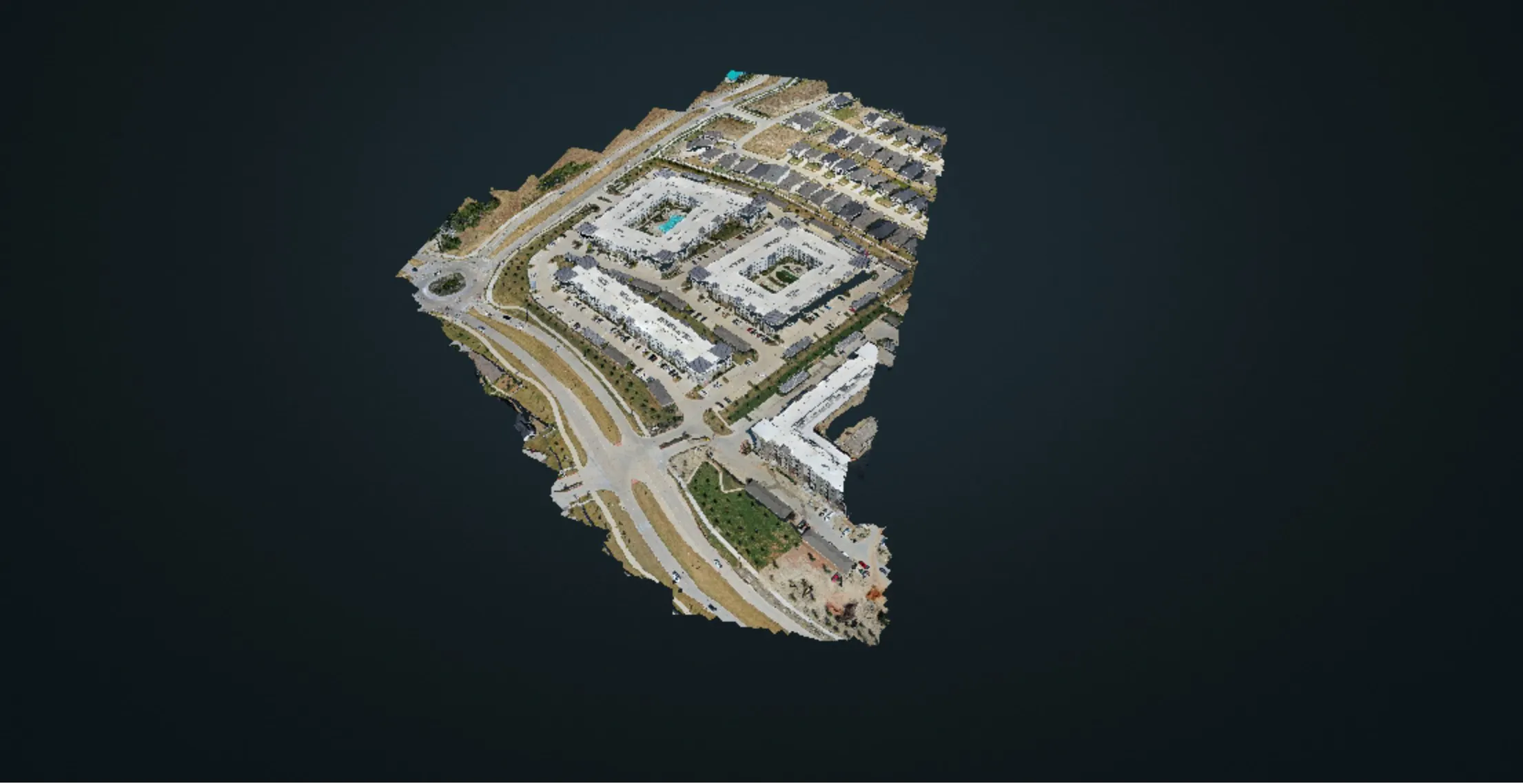
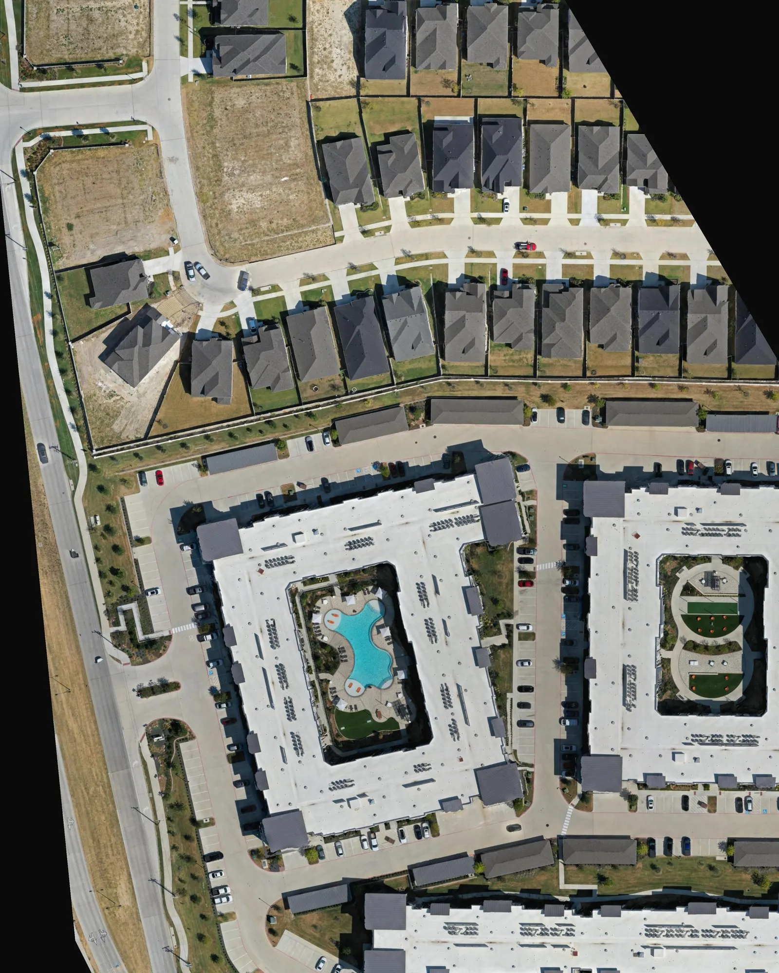
Mapping flights capture hundreds to thousands of overlapping photographs on a planned grid, with enough overlap between frames for photogrammetry software to reconstruct the site in three dimensions. From that reconstruction come the orthomosaic, a top-down image with the perspective distortion removed, the surface and terrain models, the point cloud, and every measurement the job needs.
Ground sample distance, the size of one pixel on the ground, is set by altitude and sensor. Our mapping flights typically capture one to three centimeters per pixel, and we plan altitude, overlap, and flight lines around the resolution your deliverable needs rather than flying one setting for every site.
Included in every mapping project
- Orthomosaic map, GeoTIFF plus a shareable JPG
- Digital surface model and digital terrain model
- Point cloud (LAS or LAZ) and textured 3D mesh (OBJ or FBX)
- Contours at the interval you specify, DXF or SHP
- Volumetric report per stockpile or cut and fill area, PDF and CSV
- Oblique photo set and 4K flyover video
- Processing report with ground sample distance and, with ground control, check-point results
- Cloud delivery within five business days, files yours to keep
Relative accuracy, absolute accuracy, and ground control
Two numbers matter. Relative accuracy is how well the model measures distances and volumes within itself, and a well-flown photogrammetry dataset holds that to a few centimeters, which is what stockpile volumes and cut and fill comparisons need. Absolute accuracy is how precisely the map sits on real-world coordinates. With the drone's own positioning the map lands within a couple of meters; when the deliverable has to line up with a survey, a site plan, or last quarter's dataset, we fly over ground control points set by your surveyor, and the processing report shows the check-point residuals.
A note on surveying: Image Media Lab is a drone mapping and photogrammetry provider, not a licensed land surveying firm. Boundary, topographic, and construction surveys in Texas are performed under a Registered Professional Land Surveyor (RPLS). When a project needs survey-grade or certified results, we fly and process the data under the direction of your surveyor or engineer, who sets ground control and certifies the deliverables.
The McKinney mapping case study ↘ Construction progress programs ↘ Drone inspections from $900 ↘
03 / How it works
How a drone mapping project worksFour steps,
five business days.
One certified pilot handles the authorization, the flight plan, the processing, and the delivery. Your surveyor or engineer stays in the loop wherever certification is involved.
- 01
Scope
Site address and acreage, what the data will be used for, the deliverables you need, and the accuracy tier. That last answer decides whether ground control is needed and who sets it. You get a fixed quote per site, in writing.
- 02
Airspace and flight plan
FAA Part 107 flight with LAANC authorization where the site sits in controlled airspace. Altitude, overlap, and flight lines are planned for the ground sample distance the deliverable needs, and ground control is coordinated with your surveyor when the project calls for it.
- 03
Flight day
Most sites under 150 acres are flown in a single visit of one to three hours. Work continues and nobody stops for the drone. Larger sites and corridors are flown in sections on the same plan and stitched into one dataset.
- 04
Processing and delivery
The photos are processed into the orthomosaic, the models, and the volumes, checked against the scope, and delivered on a cloud link within five business days with a processing report.
Is drone mapping the same as a land survey?
No. Image Media Lab is a drone mapping and photogrammetry provider, not a licensed land surveying firm. Boundary, topographic, and construction surveys in Texas are performed under a Registered Professional Land Surveyor. When your project needs certified results, we fly and process the data under the direction of your surveyor or engineer, who sets ground control and certifies the deliverables.
How accurate is drone photogrammetry?
Relative accuracy, the accuracy of distances and volumes measured within the model, holds to a few centimeters on a well-flown dataset, which is what stockpile volumes and cut and fill comparisons need. Absolute accuracy, how precisely the map sits on real-world coordinates, depends on ground control: with the drone's own positioning the map lands within a couple of meters; with ground control points set by your surveyor it lines up with your survey, and the processing report shows the check-point residuals. Tell us how the data will be used and we scope the accuracy tier to match.
What file formats do you deliver?
GeoTIFF orthomosaics, LAS or LAZ point clouds, OBJ or FBX textured meshes, DXF or SHP contours, and PDF or CSV volumetric reports, in the coordinate system your team already works in. If your CAD or GIS software needs something else, say so in the scope and we deliver to it.
How much does drone mapping cost in Texas?
Every mapping project is quoted per site. The number depends on acreage, the deliverables you need, the accuracy tier and ground control, and how often the site is flown. Dallas-Fort Worth carries no travel fee, the rest of Texas is quoted with travel up front, and repeat flights on the same plan are priced as a series. Send the address and the intended use and you have the number in writing within one business day.
How large a site can you map?
From a single commercial lot to several hundred acres. Sites under about 150 acres are usually flown in one visit; larger sites and linear corridors are flown in sections on the same plan and delivered as one dataset. The quote states the number of flight days.
Do you offer LiDAR or thermal mapping?
Not yet. We fly high-resolution photogrammetry, which covers most mapping, volume, and progress work. When a project needs LiDAR, for example ground models under dense tree canopy, or thermal sensors, we say so up front and coordinate with a specialist partner rather than overstating what we fly.
Where do you fly?
Dallas-Fort Worth is home and carries no travel fee. We fly across Texas with travel quoted up front, and take projects in Oklahoma and Louisiana with a travel fee on the same terms.
Start a project
Map your site.
Send the address, the acreage, and what the data is for. We reply within one business day with a fixed quote per site, the deliverables list, and the first available flight date.
Brief received
Thanks. You’ll hear from us in writing within one business day.
Your brief is with our Dallas team. If it is urgent, call (469) 370-9832 and we will pick up. If a call helps after the first reply, pick a time.