
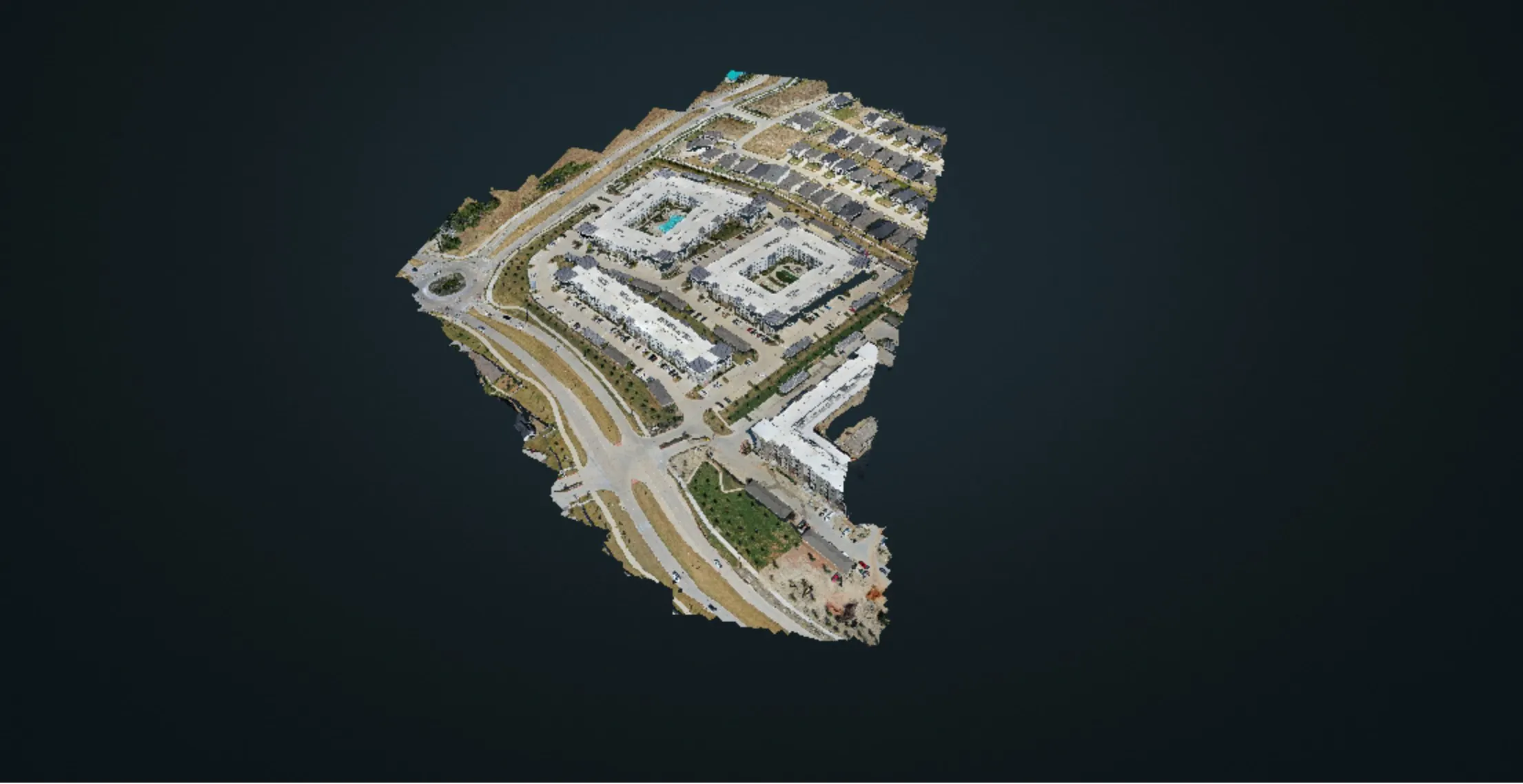
The short answer for Dallas-Fort Worth: a single construction drone progress capture starts at $1,250, and a recurring program is priced per visit. On a large active development of roughly 580 acres, mapping and progress documentation runs $2,500 per visit on a biweekly schedule or $2,700 per visit on a monthly one. Every number is fixed in writing before the first flight, and there is no travel fee inside DFW.
This guide breaks down what a progress visit delivers, what a year of flights costs, how often a site should be flown, and what moves the price up or down.
Related service: construction progress drone documentation across Texas, plus drone mapping and photogrammetry.
What is construction drone progress monitoring?
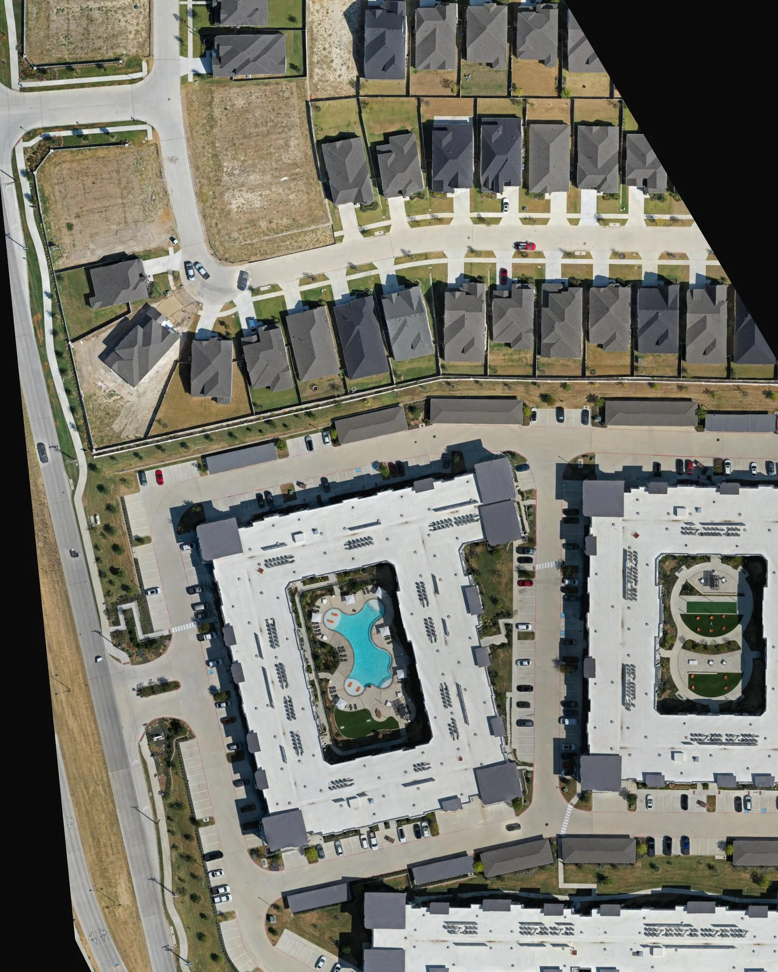
Construction drone progress monitoring is a schedule of drone flights over a job site, flown on the same saved plan every visit, so each date produces a map and a set of photos that line up with the last one. Month three compares to month one frame for frame, which is the whole point.
Each visit typically delivers three things:
- An orthomosaic. A single top-down map stitched from hundreds of overlapping drone photographs and corrected so distances read true. You get it as a browser map you can zoom and share, as a high-resolution GeoTIFF for GIS and CAD tools, and as one consistently framed 4K image for the project time-lapse.
- Fixed-view progress photos. On our programs, eight edited photographs from saved positions, altitudes, headings, and camera angles. The same eight viewpoints repeat every visit, so each one becomes a dated sequence.
- Optional creative aerials. Edited photographs and short color-corrected video clips of whatever the site is showing that day, for marketing, investor updates, and social media.
Files arrive in a dated folder within three business days of the flight for a typical site, and within five for multi-zone sites of several hundred acres. The imagery belongs to the project.
How much does construction drone progress monitoring cost in DFW?
These are our 2026 prices for Dallas-Fort Worth. The starting price covers the simplest version of each job; your written quote states the exact number before anyone flies.
| What you book | Price | What it includes |
|---|---|---|
| Single progress capture, one site | From $1,250 | One orthomosaic, fixed-view progress photos, a viewing link, and a dated delivery folder |
| Baseline capture of a large active area (about 580 acres) | $3,950 | The full area flown in planned zones and combined into one map |
| Recurring mapping and progress documentation, about 580 acres | $2,500 per visit biweekly · $2,700 per visit monthly | One orthomosaic with exports and eight fixed-view photos every visit |
| Creative aerial add-on | +$500 per visit | Ten edited photographs and six color-corrected video clips |
| Full progress and marketing program, about 580 acres | $3,800 per visit biweekly · $4,200 per visit monthly | Everything above, plus campaign video edits, visual 3D models of key features, and a finished annual progression film |
Two things hold for every row. The price is fixed before the flight, not metered afterward. And a recurring schedule is priced as a series: the more visits a year, the lower each visit costs, because planning, flight-zone layout, and processing setup are spread across more dates. That is why a biweekly visit costs less than a monthly one.
Get a fixed program quote. Send the site address, the schedule, and who needs to see the updates through the construction progress page, and the written quote and first flight date come back within one business day.
What does a full year of drone progress flights cost?
The annual number is the per-visit price times the number of visits, with no separate deposit or final-film fee on our programs. Three examples at 2026 prices:
- One building site, monthly for 12 months: 12 visits from $1,250, so from $15,000 for the year.
- A 580-acre development, mapping and progress views only: $65,000 a year biweekly (26 visits at $2,500) or $32,400 a year monthly (12 visits at $2,700).
- A 580-acre development, full progress and marketing program: $98,800 a year biweekly (26 visits at $3,800) or $50,400 a year monthly (12 visits at $4,200), including the campaign edits and the annual film.
A common middle ground is a monthly mapping schedule, with creative aerials added only at the milestones that matter for sales or investors.
How often should a construction site be flown?
Fly weekly or biweekly while the site changes fastest, during earthwork, utilities, foundations, and structure, then monthly through finish-out. Add milestone flights where the schedule needs a record: a major pour, topping out, dry-in, a model home opening, and handover.
Biweekly gives about 26 dated maps a year, enough for a smooth progression time-lapse and a tight record for claims and change orders. Monthly gives about 12, which suits slower vertical builds and owners who mainly want a monthly report image. The cadence can change mid-project, and the quote shows the per-visit price for each option so the trade-off is visible.
What moves the price of a drone progress program?
Seven things decide where a site lands in the table above:
- Acreage and flight zones. A small commercial site is one flight. A master-planned community is split into zones with separate staging spots and battery cycles, and every zone adds field time and processing.
- Cadence. More visits a year lower the price of each visit.
- Deliverables. Mapping and fixed views are the base. Creative photos and video, 3D models, and edited films add production time.
- Accuracy tier. Visual documentation, positioned by the drone’s GPS, is consistent from visit to visit and right for progress review and marketing. Measured work that must tie to real-world coordinates needs ground control points (surveyed targets on the ground), which adds setup time. Survey certification stays with a Registered Professional Land Surveyor (RPLS); we are a photogrammetry provider, not a surveying firm. Our guide to drone mapping vs. a land survey in Texas explains where that line sits.
- Airspace. Much of Dallas-Fort Worth sits inside controlled airspace around DFW International, Love Field, and the smaller airports. LAANC authorization, the FAA’s near-instant approval system, covers most job sites during planning. Sites that need a manual FAA authorization take longer, so we start that paperwork the week you sign.
- Site rules. Tower cranes, badging, safety orientation, and certificates of insurance naming the owner or general contractor are routine, and they shape the flight window.
- Travel. Dallas-Fort Worth carries no travel fee. The rest of Texas, Oklahoma, and Louisiana are quoted with travel up front.
Weather is not a price factor: if wind or rain moves a visit, the payment moves to the rescheduled date.
Is a drone program worth it compared with the alternatives?
A drone program earns its cost when someone off site needs to see the whole job, on a schedule, in a form they can compare. That is usually the owner, the lender, the sales team, or the project executive who visits once a month.
- Phone photos from the superintendent are free and useful day to day, but the angles change every time and nothing shows the whole site at once.
- Fixed jobsite cameras are excellent for daily time-lapse from one angle. A drone map complements them with the top-down view and the angles a mast camera cannot reach.
- A survey crew is still required for stakeout, boundary, and certified measurements. A drone map does not replace that work; it shows progress between survey dates.
- A helicopter or manned aircraft covers very large areas, but rarely at a biweekly cadence or a price a single project can carry.
How Image Media Lab runs a progress program
Before we offer a service, we fly it. On September 1, 2026 we mapped a 27-acre multifamily site in McKinney: one automated flight, 343 photographs, and a full-resolution map at 2.53 centimeters per pixel, processed into an orthomosaic, an elevation model, and the 3D model above. The McKinney mapping case study shows every output.
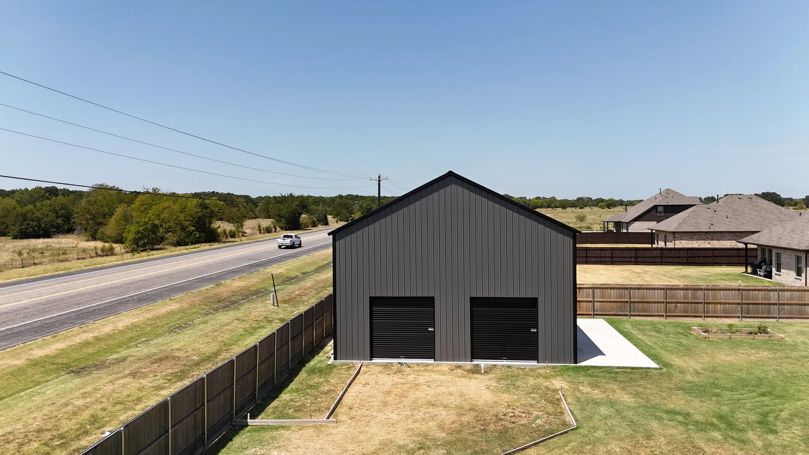
On a program, the flight plan is saved after the first visit and reused: same altitude, overlap, direction, and camera settings, so every map lines up with the last. The eight fixed views are saved as positions, not described from memory. Every flight runs under FAA Part 107 with airspace authorization handled in planning, and as a video production company we can turn the same visits into finished films, like the as-built aerials we flew for a metal building company in Greenville.
Recurring programs are set up as a 12-month schedule with each visit invoiced before it flies, rather than one large deposit up front.
Frequently asked questions
How much does a construction drone flight cost in Dallas?
A single construction progress capture starts at $1,250 in Dallas-Fort Worth, with no travel fee inside DFW. Recurring programs are priced per visit and cost less per visit as the cadence rises.
Is drone progress monitoring the same as a land survey?
No. A progress map documents what the site looks like on a date and is consistent from visit to visit. Boundary, stakeout, and certified measurements stay with a licensed RPLS, and we can fly with their ground control when a project needs survey-tied maps.
How fast do we get the files?
Within three business days of the flight for a typical site, and within five for multi-zone sites of several hundred acres. Each visit lands in its own dated folder.
Can you fly near DFW Airport or Love Field?
Yes, with authorization. Most DFW job sites get LAANC approval during planning; sites that need a manual FAA authorization take longer, so the request goes in the week you sign.
Do we have to commit to a full year?
No. A single capture is available on its own, and a program can start with one baseline flight before you choose a cadence. A recurring schedule is what brings the per-visit price down.