
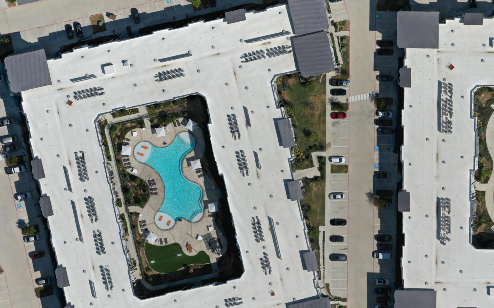
A drone map can replace a land survey when the question is what a site looks like, how much material is on it, or how it changed since last month. It cannot replace one when the answer will locate a property line, lay out lots, or go on a recorded plat. In Texas that work is professional surveying, and it belongs to a Registered Professional Land Surveyor (RPLS). Most projects need both, and they work best together.
This guide explains the difference, what Texas law says, how accurate a drone map really is, and how a drone pilot and a surveyor split the work on one site.
Related service: drone mapping and photogrammetry across Texas, plus construction progress documentation.
What is the difference between drone mapping and a land survey?
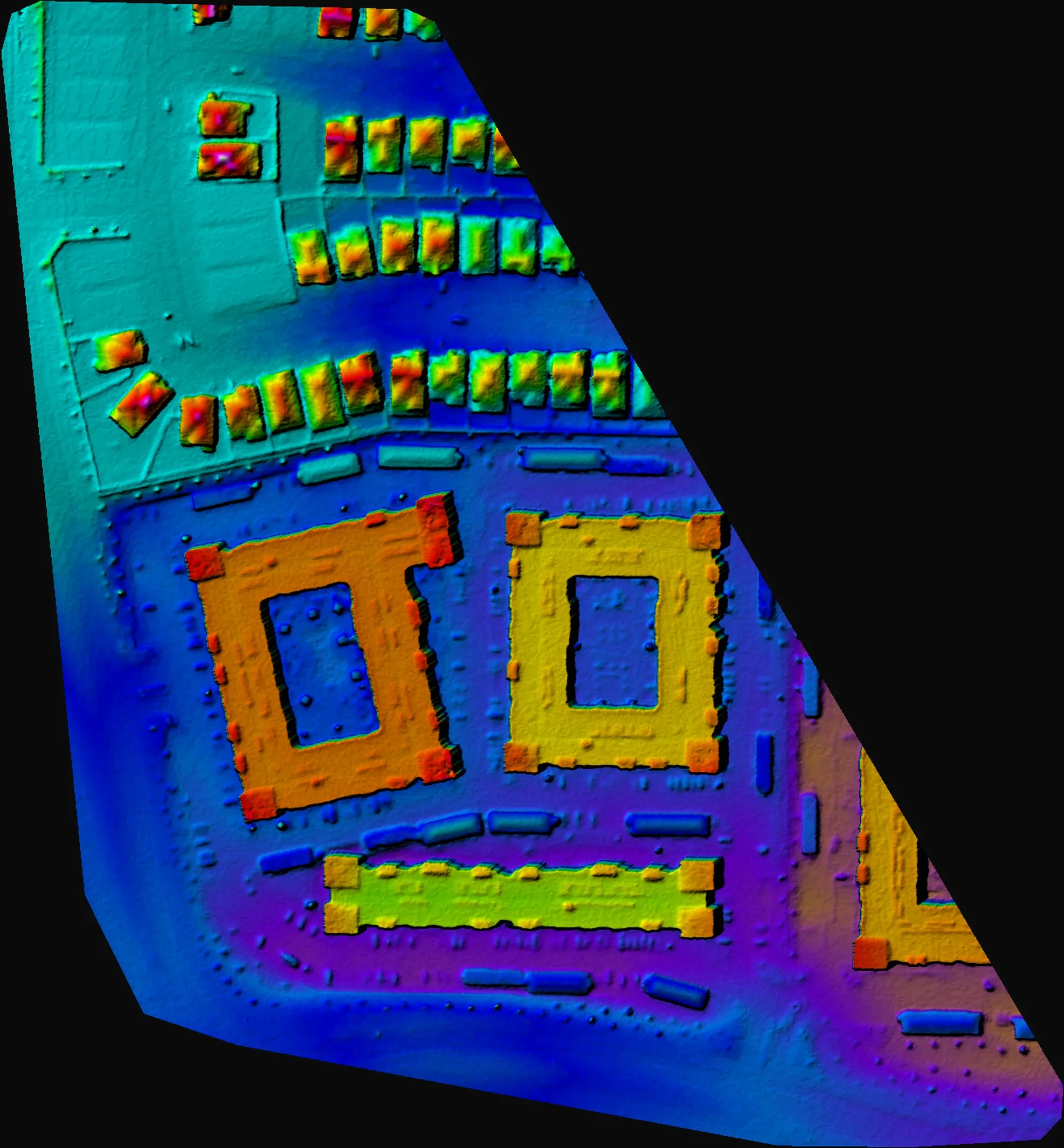
Drone mapping is photogrammetry: a drone flies a planned grid, takes hundreds of overlapping photographs, and software turns them into an orthomosaic (one top-down map corrected so distances read true), an elevation model, a 3D model, and a point cloud. It documents and measures the whole visible surface of a site in one flight.
A land survey is a licensed professional’s measured and certified statement of where things legally are: property corners, boundary lines, easements, improvements, and elevations tied to a recognized coordinate system. It ends with a signed and sealed document that a title company, a lender, a county, or a court can rely on.
The simplest way to hold the difference: a drone map shows the site, and a survey stands behind it.
What does Texas law say about drone mapping and surveying?
Texas defines professional surveying in the Occupations Code, Section 1071.002. It covers the practice of “land, boundary, or property surveying,” including measuring sites, points, lines, elevations, and features to determine areas and volumes for three purposes: locating real property boundaries, platting and laying out land and subdivisions, and preparing the maps, plats, field notes, easements, and property descriptions that represent those surveys. Mapping and data collection count as surveying “to the extent those acts are performed in connection with” that work.
Two other sections matter for drone work:
- Section 1071.004 says the chapter does not require a registered surveyor to establish an easement or a construction estimate that does not involve monumentation, delineation, or a metes and bounds description.
- Section 1071.351 says a registered surveyor may not let an unregistered person control the end product of professional surveying work. When a drone dataset becomes part of a certified survey, the surveyor runs it.
In practice, a progress map, a marketing orthomosaic, or a quantity estimate for planning is not a boundary survey. A map that someone will use to find a property line, lay out lots, or file a plat is surveyor’s work, flown or not. The Texas Board of Professional Engineers and Land Surveyors (TBPELS) licenses surveyors in Texas, and when a use case sits near the line, your surveyor or the board is the right call. This guide is practical background, not legal advice.
What can a drone map replace?
A drone map replaces slow, partial, or ground-only documentation wherever the job is to see and measure the surface rather than to certify it:
- Construction progress records. The same flight plan every visit, so each map lines up with the last. Our construction drone cost guide covers cadence and prices.
- Stockpile and earthwork estimates. Volumes for planning, inventory checks, and comparing cut and fill between dates.
- Existing-conditions records. A complete, dated picture of a site before work starts, for owners, insurers, and future disputes.
- Site measurements for planning. Roof areas, parking counts, slopes, and drainage paths read from the model.
- Marketing and stakeholder updates. A current overhead view of the whole property for sales teams, lenders, and investors.
What still needs a licensed surveyor?
Anything that establishes legal position or carries a seal stays with the RPLS:
- Boundary surveys and property corners
- ALTA/NSPS land title surveys for lenders and title companies
- Plats and replats filed with a county
- Construction staking and layout
- Metes and bounds descriptions and easement exhibits
- Certified topographic surveys used for engineering design
- FEMA elevation certificates, which must be completed by a licensed professional
A drone can still help on several of these: a surveyor can fly or hire drone mapping for topographic and existing-conditions work, then check and certify the result. The difference is who controls the end product.
How accurate is drone mapping?
Two numbers matter, and they answer different questions.
Relative accuracy is how well the model measures distances and volumes within itself. A well-flown photogrammetry dataset holds that to a few centimeters, which is what stockpile volumes and cut and fill comparisons need.
Absolute accuracy is how precisely the map sits on real-world coordinates. With the drone’s own GPS, the map lands within a couple of meters of its true position. When the deliverable has to line up with a survey, a site plan, or last quarter’s dataset, a surveyor sets ground control points (surveyed targets on the ground) before the flight, and the processing report shows the check-point residuals, the measured error at points the software did not use.
Resolution is a separate question. Ground sample distance (GSD), the size of one pixel on the ground, depends on flight altitude and the camera. Mapping flights typically capture one to three centimeters per pixel.
Our own example: on September 1, 2026 we mapped a 27-acre multifamily site in McKinney with one automated flight and 343 photographs, at 2.53 centimeters per pixel. Georeferencing was GPS only, so the model is consistent within itself to a few centimeters while its absolute position sits within a couple of meters. That is exactly right for measuring roofs, parking, and stockpiles on the site, and exactly wrong for staking a building corner. The McKinney mapping case study shows every output.
How do a drone pilot and a surveyor work together?
On projects that need both, the work splits cleanly:
- The surveyor sets control. Ground control points and check points go in before the flight, in the coordinate system the project already uses. Around Dallas-Fort Worth that is usually Texas State Plane, North Central zone.
- The drone flies the site. One flight captures the whole surface instead of a crew collecting individual points, planned for the resolution the deliverable needs.
- Processing ties the map to the control. The orthomosaic, elevation model, and point cloud are adjusted to the ground control, and the report lists the residuals at each check point.
- The surveyor reviews and certifies. Where a sealed deliverable is required, the surveyor checks the data against their own measurements and owns the final product.
The surveyor spends their time on control and certification instead of collecting thousands of points, and the project gets a complete visual record on top of the survey.
How much does drone mapping cost compared with a survey?
A single drone mapping capture of one site starts at $1,250 in Dallas-Fort Worth, with no travel fee inside DFW; recurring schedules are priced per visit. Survey work, including setting ground control, is quoted by the surveyor and depends on the site and the deliverable. For most sites the drone map does not replace the survey bill; it replaces repeat visits, partial photos, and guesswork between survey dates.
Plan a mapping flight. Send the site address, the acreage, and what the map will be used for through the drone mapping page. We reply within one business day with the accuracy tier, whether ground control is needed, and a fixed quote.
Frequently asked questions
Can a drone survey replace a boundary survey in Texas?
No. Locating property boundaries is professional surveying under Texas Occupations Code Section 1071.002 and requires a Registered Professional Land Surveyor. A drone map can show the site around the boundary, but it cannot establish where the line is.
Is drone mapping accurate enough for stockpile volumes?
Yes, in most cases. Volumes depend on relative accuracy, which a well-flown dataset holds to a few centimeters. If the volumes settle a payment or a dispute, add surveyed ground control and check points so the numbers can be verified.
Do I need a surveyor for a drone map in Texas?
Not for progress records, marketing maps, or planning estimates. You need one when the map will be used to locate boundaries, lay out land, prepare a plat, or produce any certified deliverable.
Can you fly with our surveyor’s ground control?
Yes. Your surveyor sets the ground control and check points, we fly and process the data to them, and the surveyor reviews and certifies the deliverables that need a seal.
How long does a drone map take?
Most sites are flown in a few hours. Mapping deliverables arrive on a cloud link within five business days, with a processing report showing the ground sample distance and, when ground control is used, the check-point results.